Image Orthorectification
At CartoSolution, one of the many services we provide is orthorectification. This is simply remotely-sensed or Drone imagery that has been geometrically processed. This geometric correction, or orthorectification, is need to fix the lens distortion, topographical relief and camera tilt. The post orthorectified image has a constant scale wherein features are represented in their 'true' positions. This allows for the accurate direct measurement of distances, angles, and areas
Deliverables are available at various raster resolutions, applicable for many different uses. Raster resolution refers to the actual distance on the ground each pixel represents in the ortho photography. A 32cm pixel resolution means each pixel in the image covers one 32cm on the ground. OrthoImage resolutions include three-inch per pixel, six-inch per pixel, and one-foot per pixel. Higher resolution imagery delivers greater visible detail. The end result of an orthorectified data is an very accurate measurement of the surface of the terrain. Which allows precise digitization, and same scale on all corner of map or image.
TYPICAL USES OF ORTHOPHOTOGRAPHY:
- Annual base map update
- Planimetric feature extraction
- Image analysis
- GIS base layer / Land base
- Post-incident management
- Asset management
- Right-of-way mapping
- Alignment mapping
- Public & private land development
- Urban planning
ORTHOIMAGERY PRODUCT DELIVERABLES
- Aerial photography data will be delivered in raster format.
- Metadata
- Orthophotography deliverable from FTP.
- Planimetric (GIS) Feature Extraction
- 3D Visualized data
- Elevation Modele

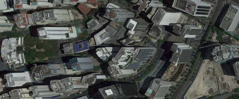
WHAT ARE TRUE ORTHOS?
Drone photos and Satellite images do not project features in their correct position due to distortion caused by the tilt of the sensor and terrain relief. The standard orthophoto rectification only corrects relief displacement in ground level features, above ground features, such as the buildings and bridges, not corrected because they are not optimized with the digital terrain model. The Processed orthophoto, features appear distorted in the form of building overlaped and warped bridges. Using the True Orthophotography technique, streets and other features surrounding buildings are clearly visible. Find More...

Sensor model rectification
Rational function model rectification
Orthorectification reprojection
General orthorectification workflow
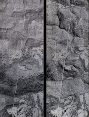
The image on the right has been rectified image and the road appears planimetrically correct.