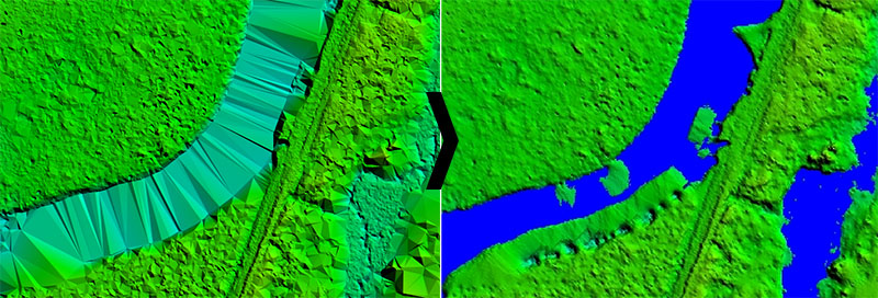
The response of water surfaces to light detection and ranging (lidar) pulses is unpredictable, which results in sparse lidar point density with varying intensity values. Due to the sparseness of the point cloud and lack of natural breaklines, lidar-derived digital elevation model (DEM) can produce unnatural surface over waterbodies. Such surfaces are not cartographically pleasing and can cause issues in the hydrologic and hydraulic modelling of a river. Hydro-flattening is the process of creating a lidar-derived DEM in which water surfaces appear and behave as they would in traditional topographic DEMs generated from photogrammetric digital terrain models.
Hydrological flattening involves assigning lakes and streams elevation values to remove “bad” points. What this means is when LiDAR is flown, the results over the water can be variable. For the purposes of watershed modelling we need for the lakes to be a lower elevation than the streams flowing into the lakes or it can create inaccurate flow direction models. In the case of rivers we do not want to assign a single elevation but instead provide an elevation gradient derived from the dem. Model builder was used for many of these processes.
WE ARE HERE TO HELP YOU
For more information or work order for 3D Visualization services, call CartoSolution Client support at (+91 931 528 1315), or contact us by e-mail at hello@cartosolution.com