Floodplain Mapping
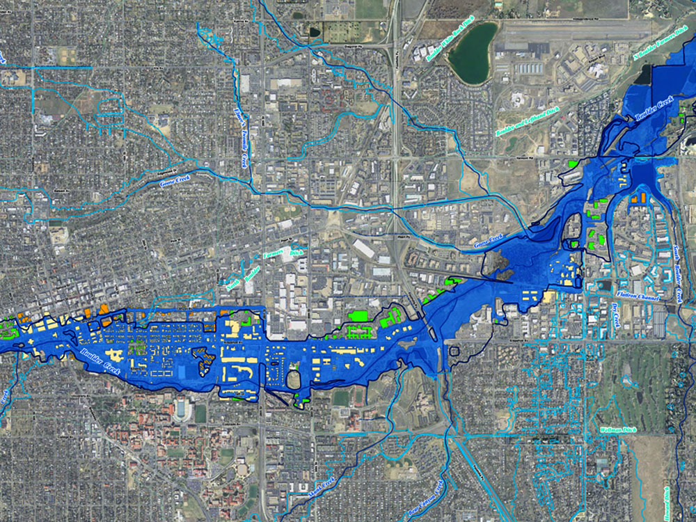
Floodplain maps identify areas that experience periodic flooding from nearby rivers, lakes, streams and the sea and provide information on the spatial distribution of flood construction levels.
These areas are designated as floodplains. Floodplain maps show the location of the normal channel of a water course, surrounding features or developments, ground elevation contours, flood levels and floodplain limits—the elevation and horizontal extent of the high water marks of a 200-year flood.
Types of flood Maps
Floodplain Maps by Region :- Area that are highly susceptible to flooding have been designated as floodplains by the federal and provincial governments.
Coastal Floodplain Maps :- Coastal floodplain mapping identifies coastal flood hazards, such as sea level rise, and provides guidance for land use planning.
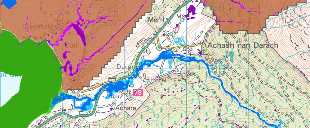
Emergency Planning Floodplain Maps :- Floodplain maps of the extent of the Fraser River floodplain are available for the purposes of flood evacuation emergency planning.
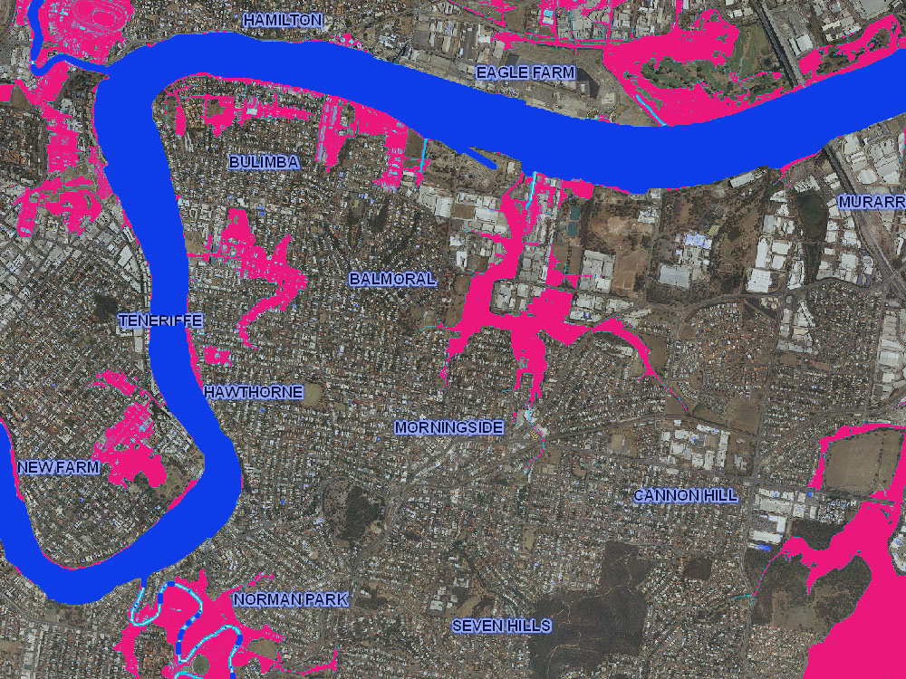
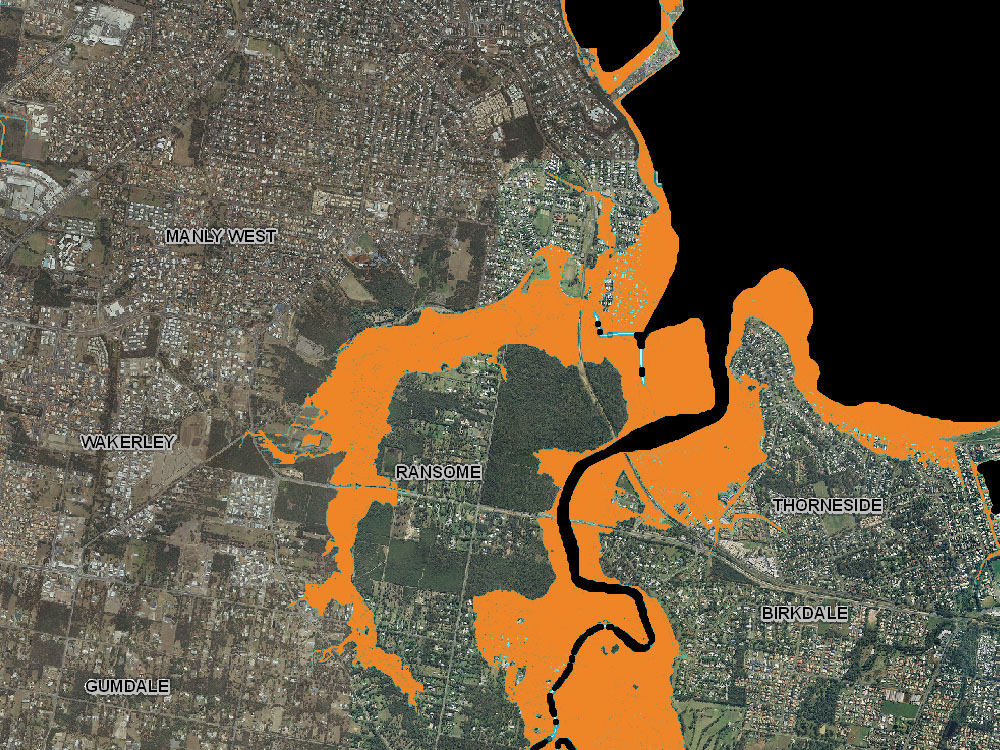
Flood Insurance Rate Maps :- Floodplain maps provide the basis for floodplain management, regulation, and insurance requirements by identifying flood-prone areas that may threaten life and property. Floodplain maps are reviewed and approved by FEMA. Once approved, the floodplain maps guide flood management programs, including floodplain regulation, safety, preservation, preparation and mitigation.
Mapping Services
- Floodplain Maps by Region
- Coastal Floodplain Maps
- Emergency Planning Floodplain
- Flood Insurance Rate Maps
- Flood Zone Classification
- Flood Hazard
- Evacuation maps
Deliverables
- .shp (ESRI)
- GeoDatabase (ESRI)
- .dwg (AutoCAD)
- Open GIS
- Large Document format
- Geocoded PDFs
Coastal Floodplain Maps
Emergency Planning Floodplain

Flood Insurance Rate Maps

Flood modelling for emergency response planning is quite different than flood mapping for insurance purposes. The main modelling goals for emergency response planning are a reasonable estimate of inundation areas and response times, while keeping the model development costs to a minimum. Using a 2D model precluded the need to spend a lot of man-hours developing model geometry, and defining flow paths and flow splits. All of these were taken directly from the specified topography. By using a tool like MIKE 21 we were able to quickly develop representative flood models for emergency response planning at low cost.”